We can think of the Ohio River as a system, or a set of systems. What systems are there? How do they intersect, or not intersect?
A subway map is a classic way of representing a system. How do we get from one point to another? What subway lines are there? What are their names? What junctions are there — where do the lines intersect? Are there other systems, such as bus lines, with which our subway system intersects? Or can you not get there from here?

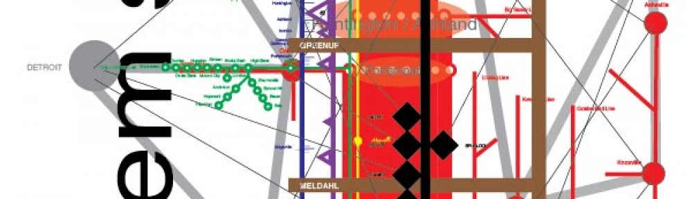
Subway lines
The classic of this form is Henry C. Beck’s 1933 Map of the London Underground. The David Rumsey Map Collection has the 1947 edition. Subway maps depict the structure of a system while eliminating topographic structure. Technically they should be called diagrams (Garland 1994:frontispiece). An exhibit from the Victoria and Albert Museum discusses this point and shows how Beck’s map developed over time. Whether a map should show details of landscape has always been contentious, as with the case of the current subway map for New York City. Maps of the New York City subway system date from the 1880’s. Mark Ovenden’s 2007 Transit Maps of the World gives examples from many places. For an example of a map which takes the form of a subway map, but which is not about subways, see de DeLong’s Subway maps of wine country.
Thank you to the person at the 2013 Ohio River Basin Alliance conference who gave me the idea to conceptualize the Ohio River in this way.
